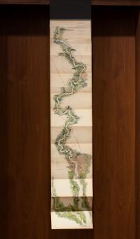
Tombleson’s Panoramic Map of the Thames and Medway
William Tombleson (1795–c. 1846, British)
Tombleson’s Panoramic Map of the Thames and Medway
London: J. Reynolds, 1875
This extended map of the Thames tracks its tributaries, islands, and course, but especially the record of thousands of years of human interaction with the river: settlements, bridges, locks and weirs, canals, ferry crossings, and railroads. Major docks in London are marked, as is the Thames Tunnel, and the entire river is measured out, upstream and down, with the distance from London Bridge.
Post-war technologies, like satellites, have reformed cartography as a science. Our modern conception of a map is epitomized by Google Maps: a seamless composite of interactive images useful for their geographical precision. Still, the utility of these new maps relies on the same processes-- the abstraction of space and the filtering of information-- which characterize the 19th century Tombleson map.
The Tombleson map aspires to naturalism, if not accuracy. Space is distorted and collapsed to pack in geographic detail around the Thames river. The map elects to identify human-made features over natural ones, meticulously transcribing the names of towns, bridges, ferries, and railways. Yet its equally detailed portrayal of the terrain--etchings of hills, trees, farmland and islets-- affirms nature's importance to the history of human settlement around the river, whose course has dictated this society's growth. These visual elements are also designed for aesthetic pleasure. The river's serpentine shape resembles a raised vein, or a line traced by a lazy finger, while the map's birds-eye view gives the illusion of mastery, imagining the world as a sliver of land which dissipates as it rolls outward from the Thames' banks.
Human touch is present in both the production of the map and the built forms it depicts. Compare the map to Meike Nixdorf's Your Earth Transforms series, whose verisimilitude at first disguises the artist's manipulation of nature. Nixdorf collapses and re-imagines space, constructing dense, fictional mountain ranges from the images of real ones. Like the Tombleson map, there is a sense of diachrony in her pictures, whose chilly, prehistoric landscapes index glacial paths and the movement of tectonic plates. Yet unlike the map, a record of human activity at first appears absent in Nixdorf's geographies. Instead, human intervention reveals itself in the act of image-making, in which the artist has digitally fractured and re-assembled the land.
This page has paths:
Contents of this path:
This page has replies:
-
Although Meike Nixdorf’s pictures might appear to represent actual views of jagged mountains, flowing glaciers, and alpine lakes, they are in reality composite images appropriated from Google Earth. Splicing together mountain ranges like the Alps, Cascades, Himalayas, or Karakoram, Nixdorf digitally melds these remote places and climates. The jarring juxtaposition of green grass and glacial ice more accurately represents the Earth’s geologic transformation over millennia than one place at a single moment in time. She playfully expands on Google’s boastful claim that it gives you “The whole word, in your hands,” by conveying the Earth’s “sense of change and movement.” Her digital constructions assert the limitations of both photography and human lifespans to observe the Earth’s perpetual state of flux. Real yet unreal, they reinforce the mutability and fragility of the Earth’s surface, as well as our capacity to alter it.
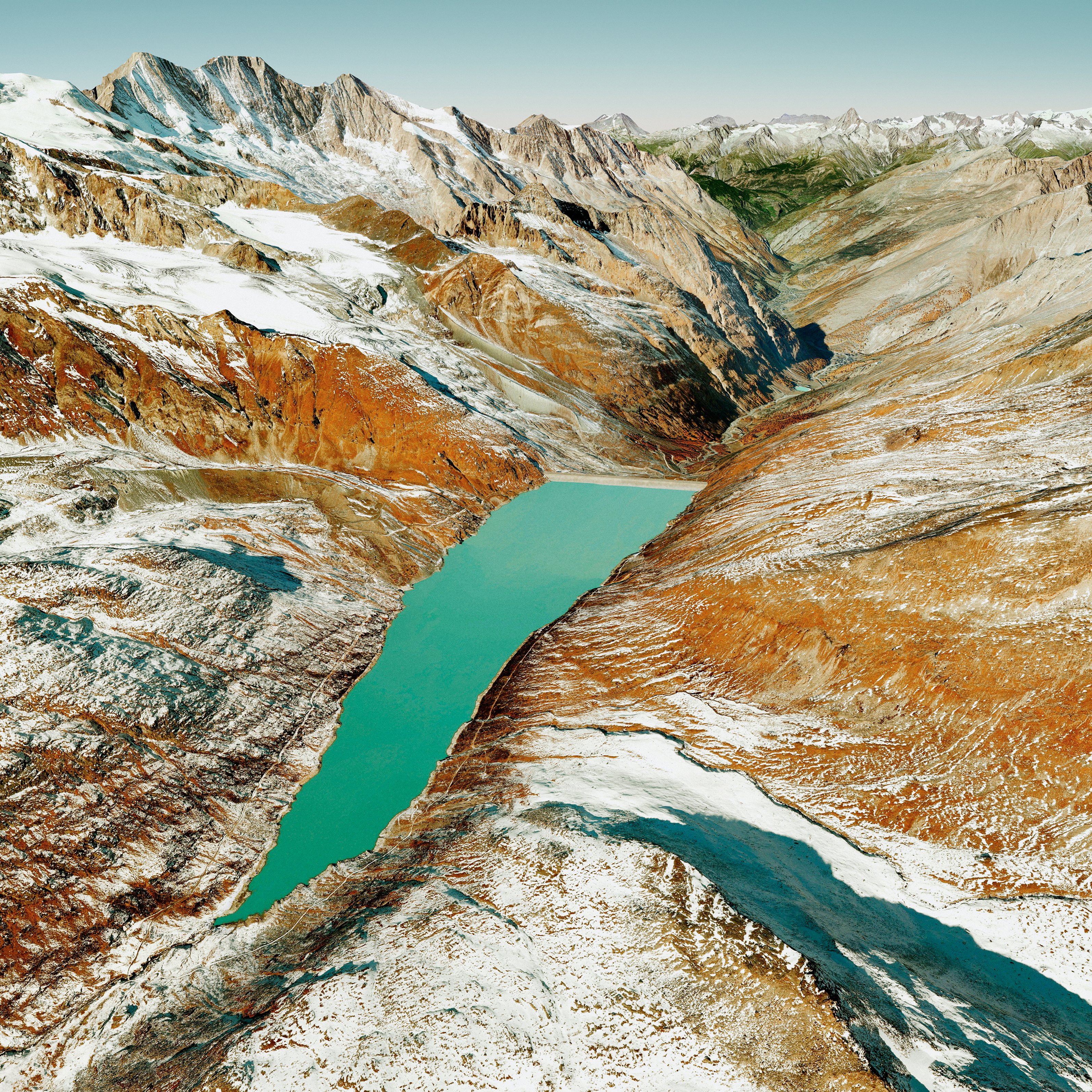
Meike Nixdorf (b.1976, lives in Stuttgart, Germany)
Plate #18, 2015
from the Your Earth Transforms series
Archival pigment print on cotton rag paper, edition 2 of 5
Recent acquisition, 2018.6.8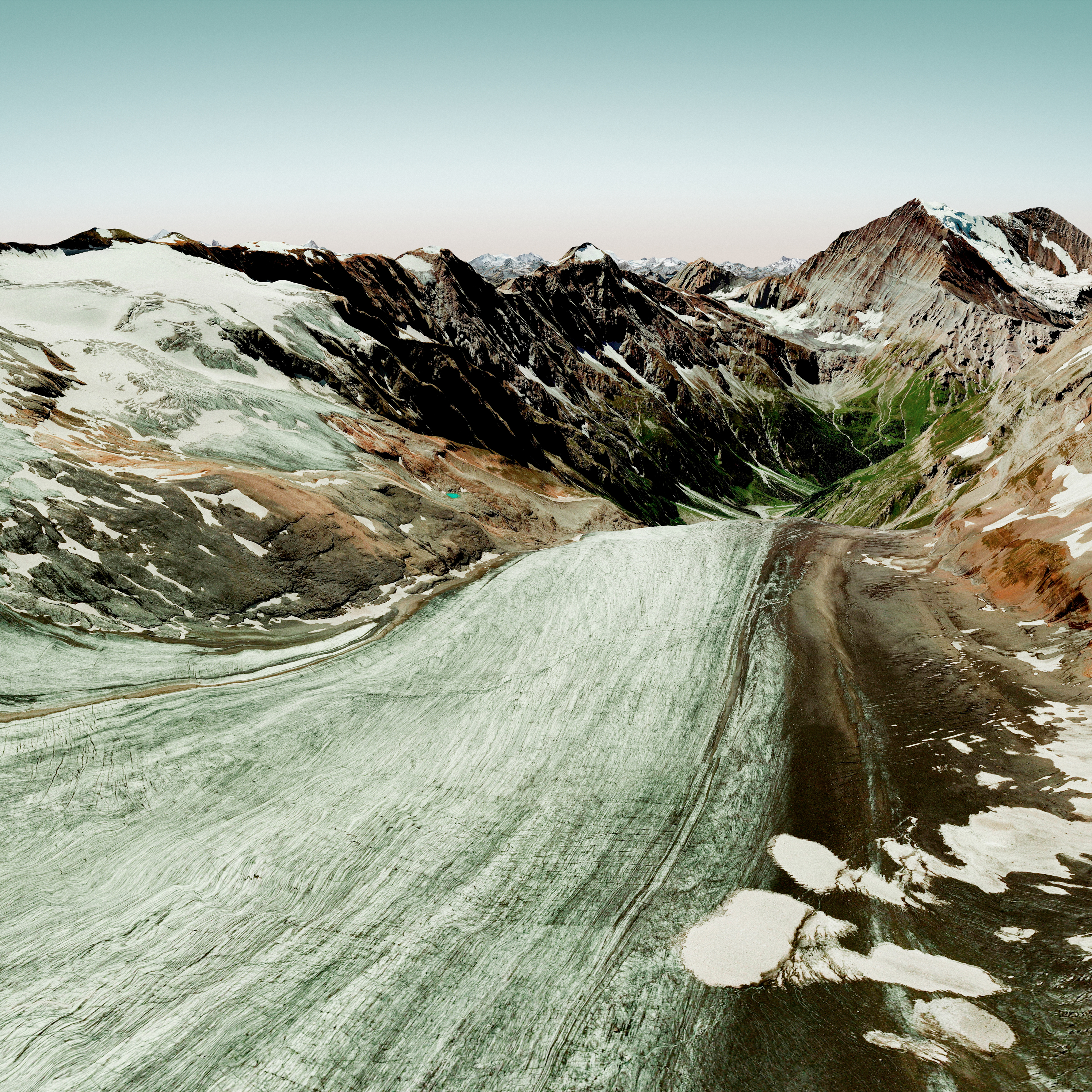
Meike Nixdorf (b.1976, lives in Stuttgart, Germany)
Plate #1, 2015
from the Your Earth Transforms series
Archival pigment print on cotton rag paper, edition 1 of 5
Recent acquisition, 2018.6.7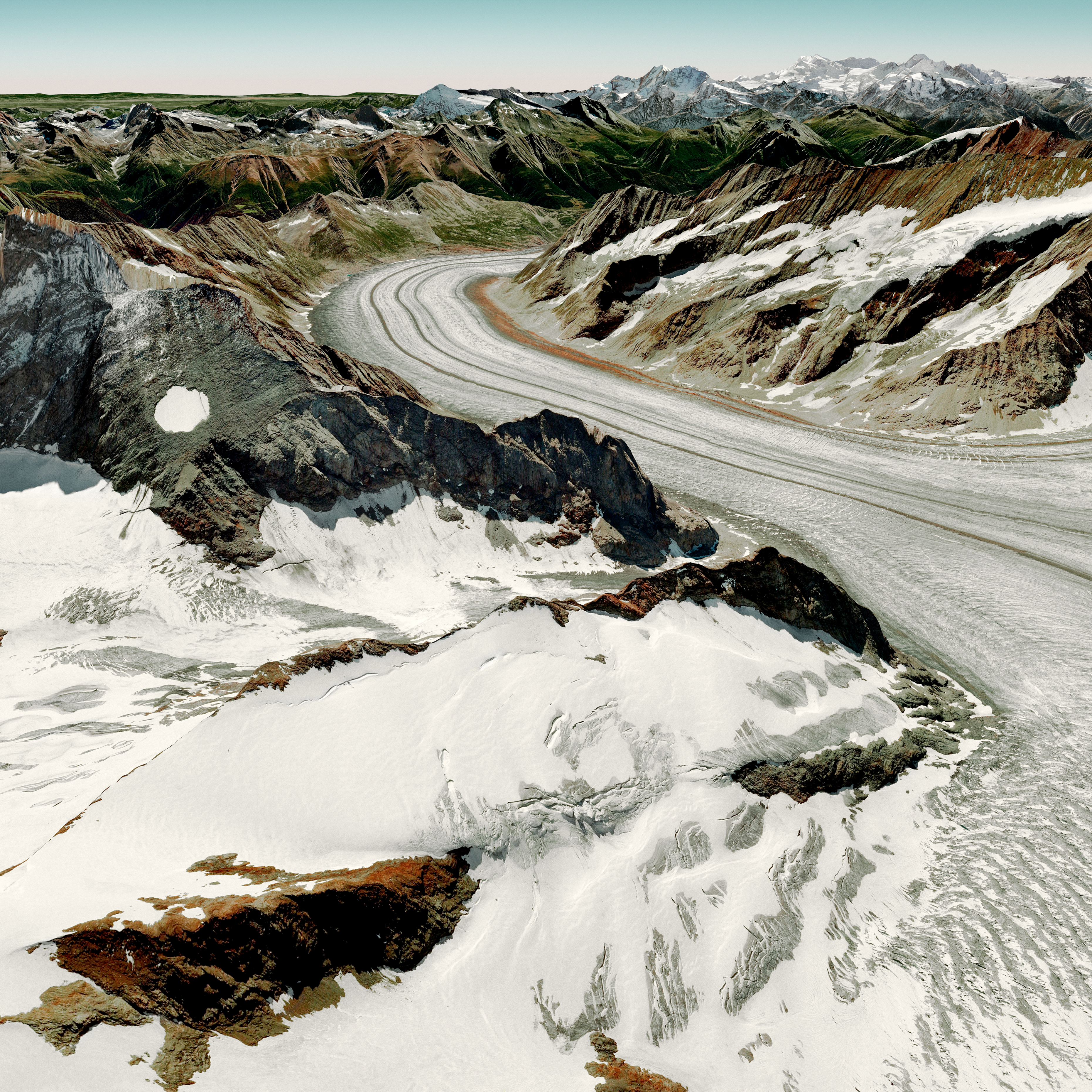
Meike Nixdorf (b.1976, lives in Stuttgart, Germany)
Plate #13, 2015
from the Your Earth Transforms series
Archival pigment print on cotton rag paper, edition 1 of 5
Recent acquisition, 2018.6.6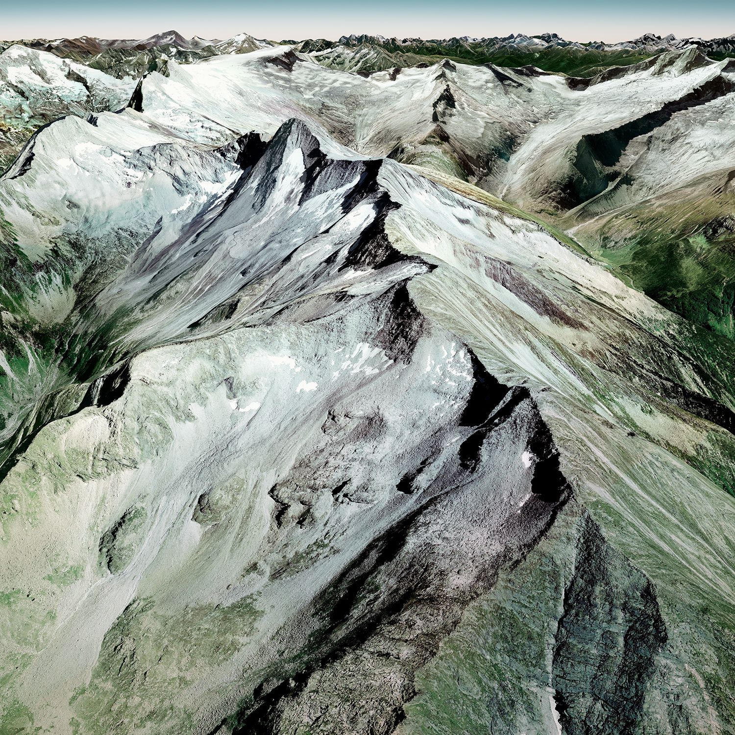
Meike Nixdorf (b.1976, lives in Stuttgart, Germany)
Plate #24, 2015
from the Your Earth Transforms series
Archival pigment print on cotton rag paper, edition 1 of 5
On loan from Sasha Wolf Projects